Annapurna Sanctuary Trek 2026 › Trek day 1
Day 1: Nayapul to Ulleri
Mon 21 Sep 2026 · trip day 4 · itinerary PDF
From the itinerary
Start
820 m (Pokhara)
Finish
2,050 m
Distance
~8–10 km
Gain
+1,230 m
Time
4–5 h
Drive from Pokhara to Nayapul, the traditional start of the route. Meet the porters, organise daypacks and begin trekking into the foothills.
The trail climbs at once through terraced farmland and small villages linked by steep stone staircases; the lower section is warm and humid with banana trees and rice terraces.
Views widen across the valley as you gain height and Magar farming villages appear. The final climb into Ulleri is steep, on long stone staircases into a village perched high above the hillside.
Tip: Take the staircase sections slowly and steadily — finding your pace early makes the trek much more enjoyable.
Route
Download GPX Nayapul → Birethanti → Sudame → Tikhedhunga → Ulleri
Computed from the track (OSM routing, Copernicus GLO-30 elevations, 20 m hysteresis for gain/loss):
Distance
10.6 km
Gain
+1190 m
Loss
−180 m
Start
1030 m
Finish
2047 m
High point
2047 m
Elevation profile
Maps
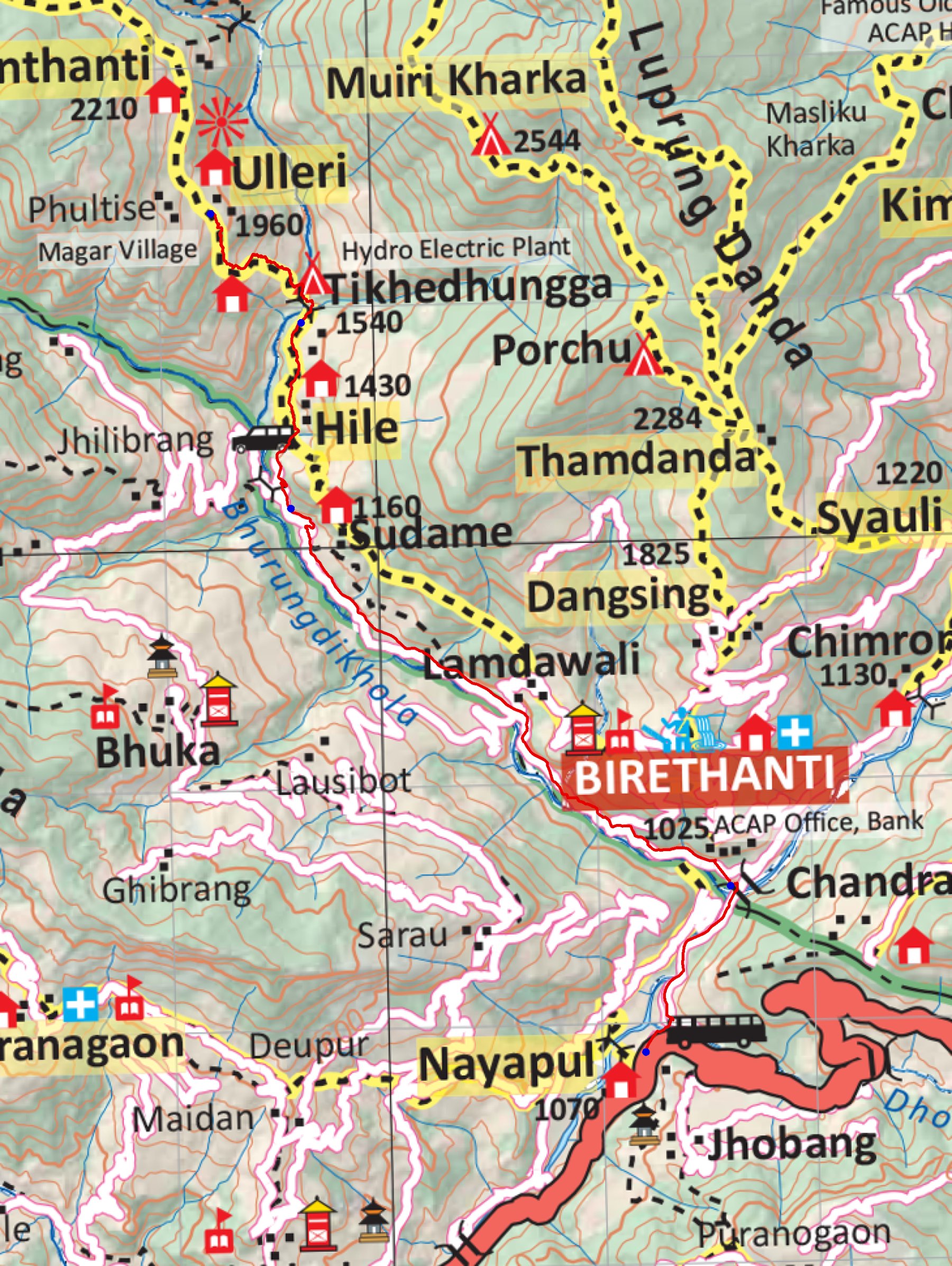
trek/maps/day01_np107.tif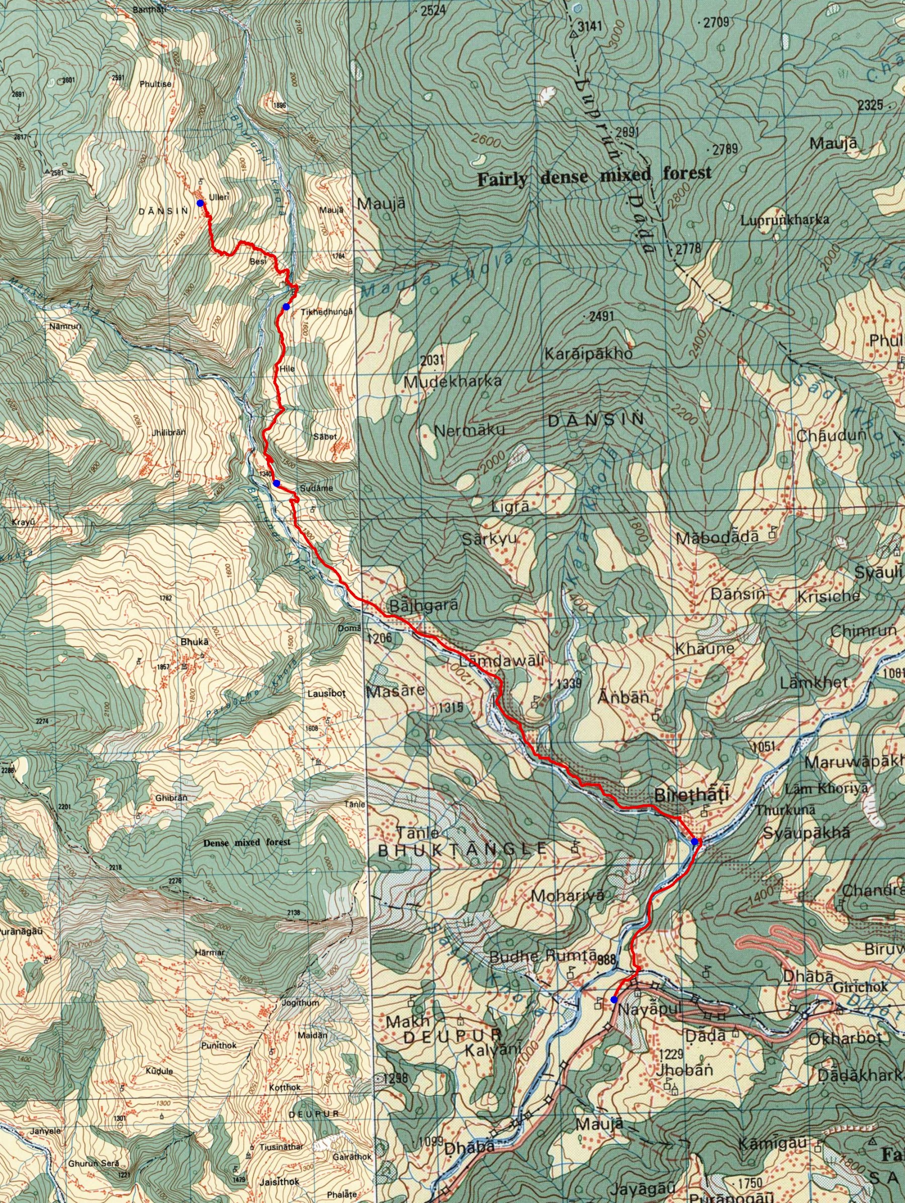
trek/maps/day01_topo.tif