Day 4: Tadapani to Chhomrong
Thu 24 Sep 2026 · trip day 7 · itinerary PDF
From the itinerary
Forest trails, ridgeline walking and long descents into river valleys before climbing again toward Chhomrong.
Descending through forest and over suspension bridges you pass small Gurung villages surrounded by terraced farmland and stone houses; the route then climbs steadily to Chhomrong, the gateway to the Annapurna Sanctuary.
Perched above the valley, Chhomrong has fine views toward Machhapuchhre and is one of the largest settlements on the route.
Route
Three candidate lines for this day — the itinerary text (ridgeline, long descent, suspension bridges, Gurung villages) fits Options B and C better than A; all are provided.
Option A — direct via Chuile
Download GPX Tadapani → Chuile → Chhomrong
Computed from the track (OSM routing, Copernicus GLO-30 elevations, 20 m hysteresis for gain/loss):
The shortest line: north-east from Tadapani to Chuile, across the upper Kimrong Khola and over Chomrong Pass. Less ridge walking than the itinerary text describes.
Elevation profile
Maps
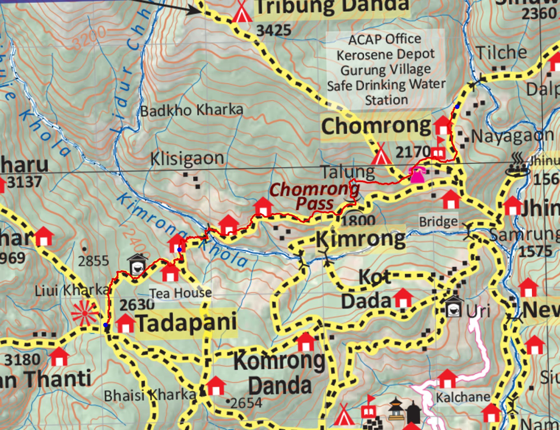
trek/maps/day04_np107.tif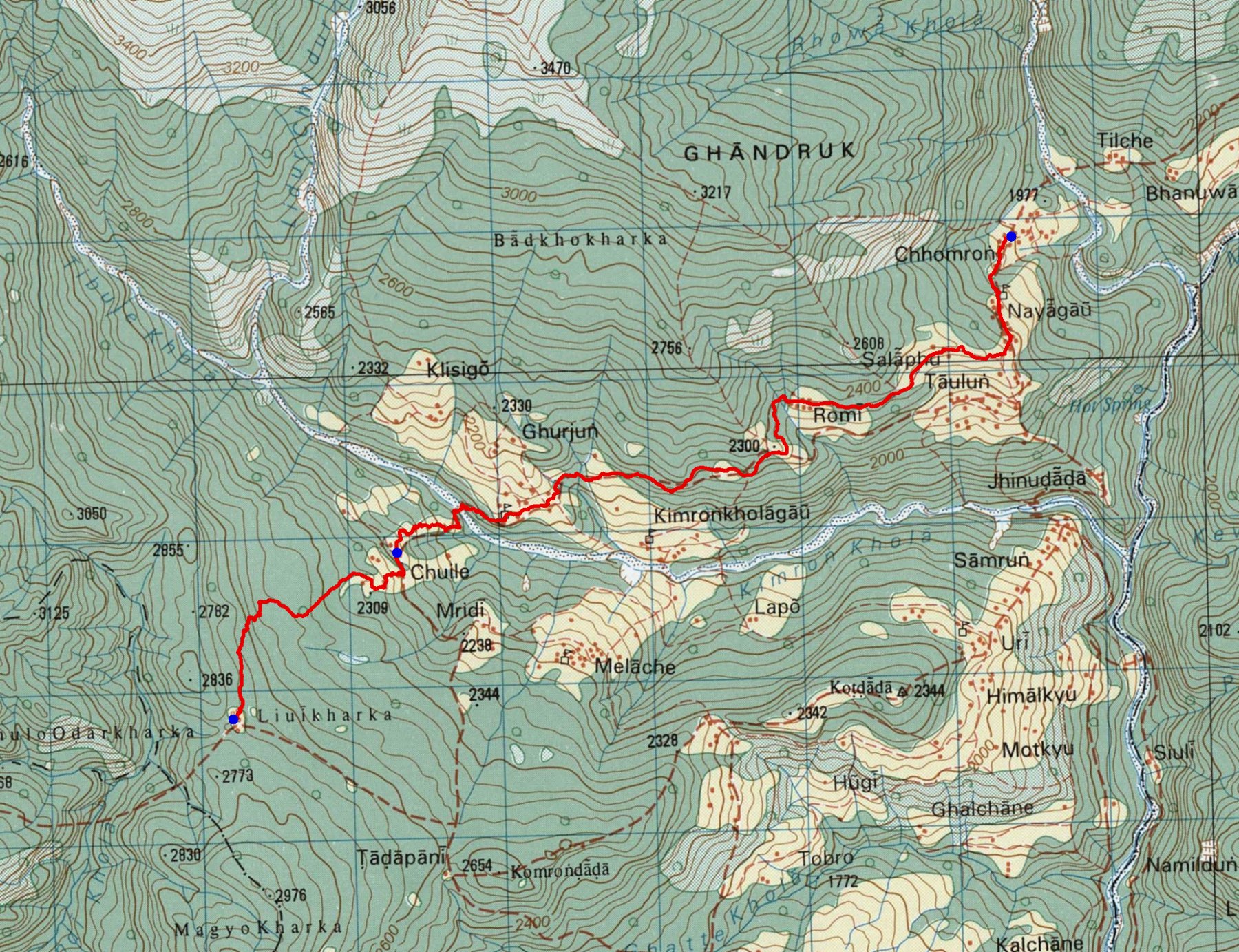
trek/maps/day04_topo.tifOption B — Komrong Danda ridge
Download GPX Tadapani → Komrong Danda → Kimrong Khola → Chhomrong
Computed from the track (OSM routing, Copernicus GLO-30 elevations, 20 m hysteresis for gain/loss):
East from Tadapani along the crest of the Komrong Danda, a long descent through Melache to the Kimrong Khola bridge, then up through Kimrong to Chomrong Pass and Chhomrong. This fits the PDF's "ridgeline walking and long descents into river valleys" better.
Elevation profile
Maps
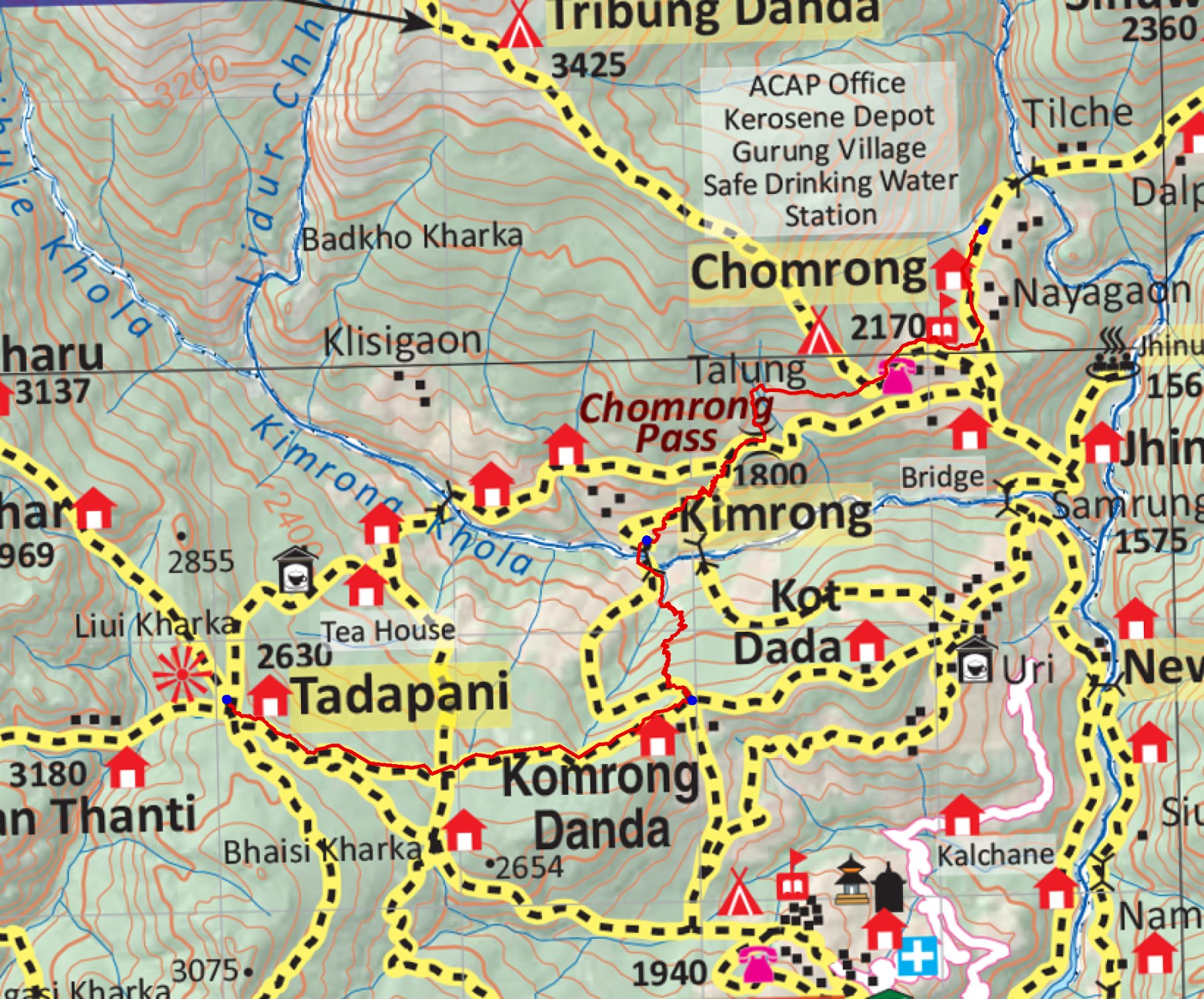
trek/maps/day04b_np107.tif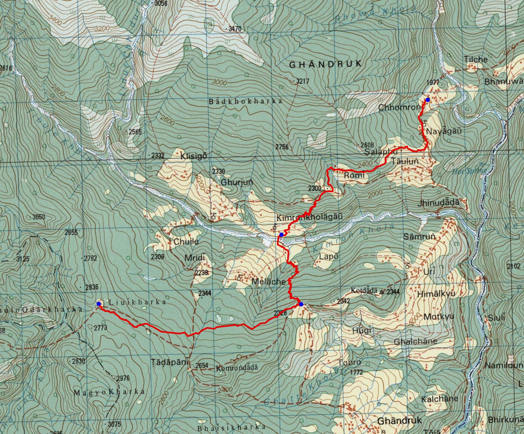
trek/maps/day04b_topo.tifOption C — full ridge to Samrung
Download GPX Tadapani → Komrong Danda → Uri → Samrung → Jhinu Danda → Chhomrong
Computed from the track (OSM routing, Copernicus GLO-30 elevations, 20 m hysteresis for gain/loss):
Stays on the Komrong Danda crest past Kot Dada to Uri, then a long descent to Samrung, across the Kimrong Khola suspension bridge near its confluence with the Modi Khola, and up through Jhinu Danda and Taulun to Chhomrong. Longest descent and the most villages of the three.
Elevation profile
Maps
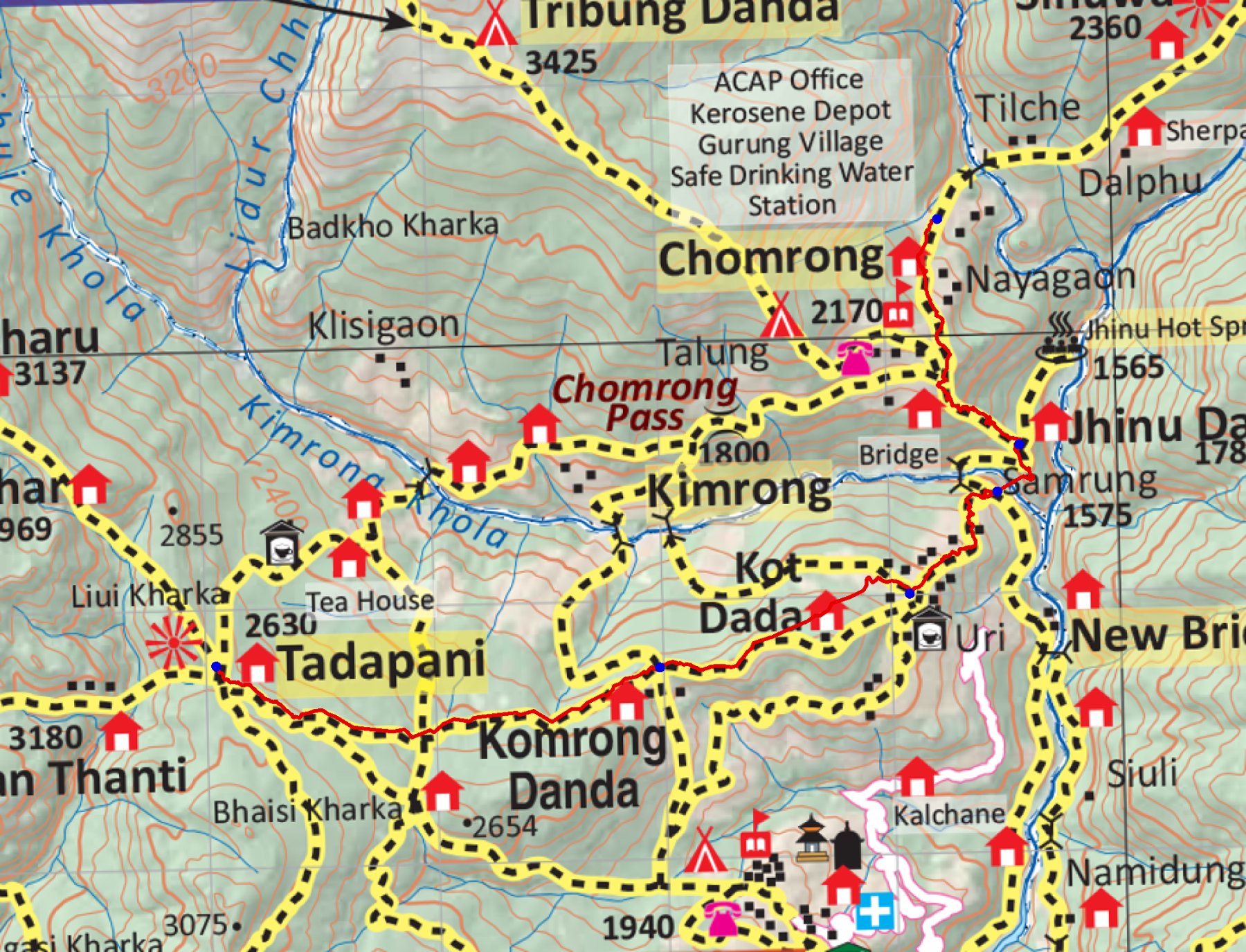
trek/maps/day04c_np107.tif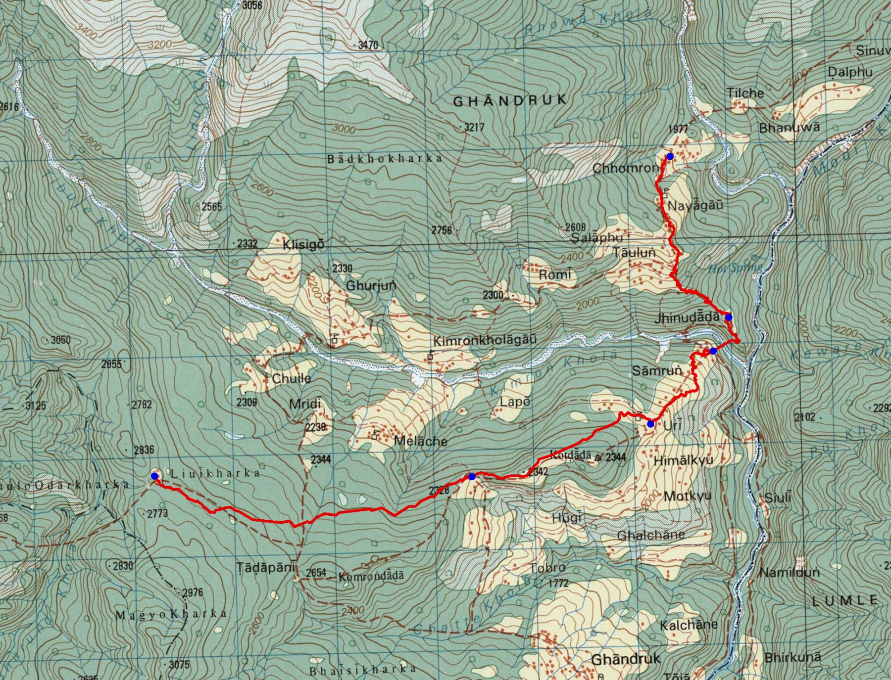
trek/maps/day04c_topo.tif